The Peninsula
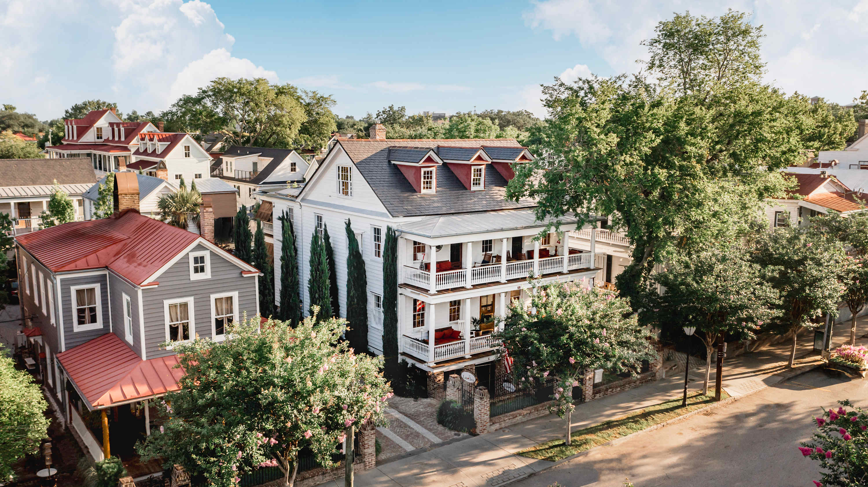
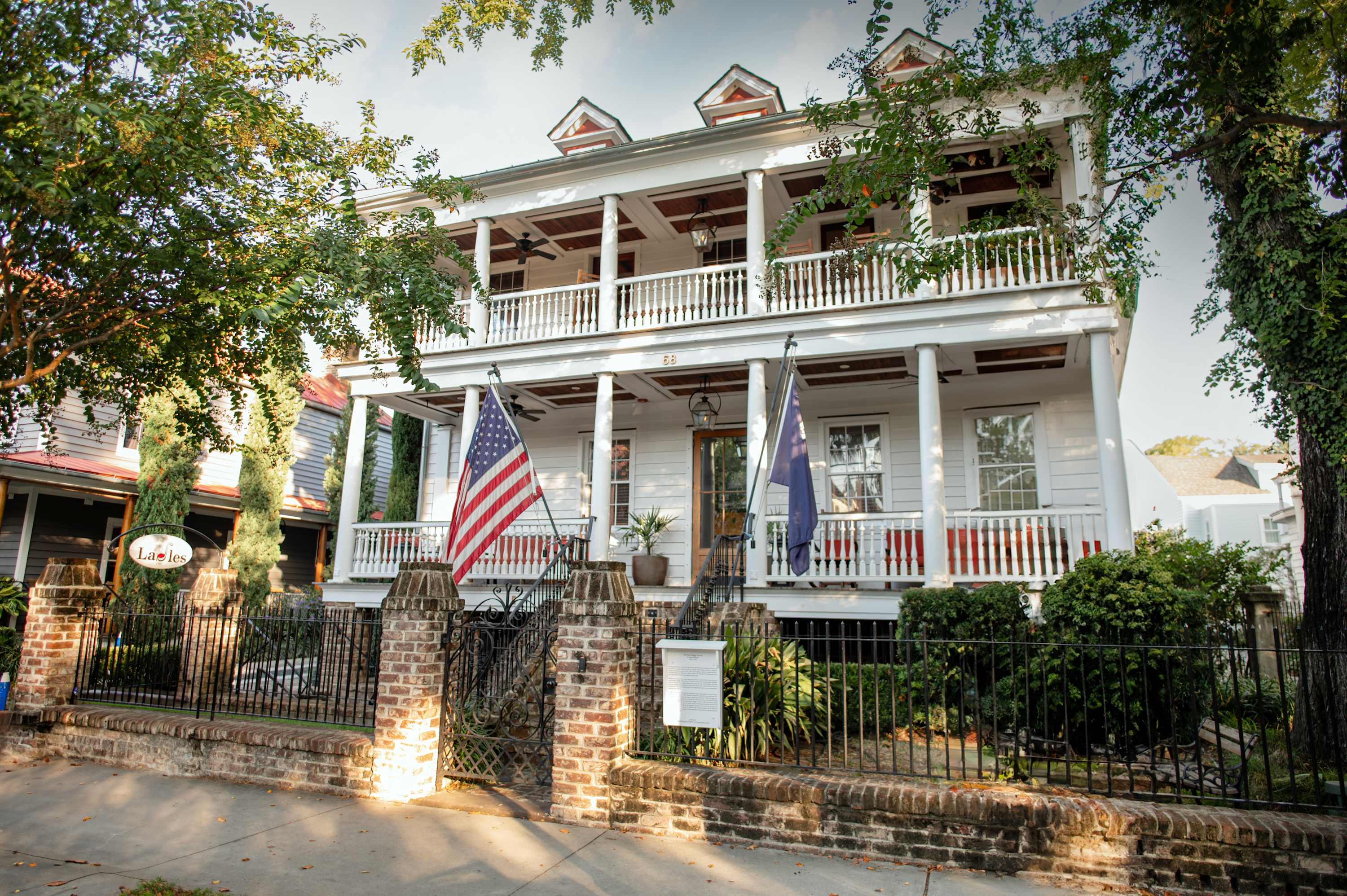
Charleston occupies a peninsula where the Ashley and Cooper rivers meet before flowing into Charleston Harbor. The Historic District at the south end of the peninsula — bounded roughly by Broad Street on the north, the Ashley River on the west, and the Cooper River on the east — contains the largest concentration of pre-Civil War architecture in the United States. The streetscape has been protected since 1931 by the nation's first historic preservation ordinance, and the results are visible: block after block of 18th and 19th century row houses, single houses (a local building type designed to catch the prevailing sea breeze), and antebellum mansions separated by piazzas (the local term for the covered porch, often running the full length of the house).
Rainbow Row on East Bay Street — 13 Georgian row houses built in the 1740s and painted in pastel colors since the 1930s — is the most photographed streetscape in the South. The colors were not original; merchants painted their buildings to stand out to ships in the harbor.
The Battery is the seawall promenade at the southern tip of the peninsula, facing the harbor and Fort Sumter. The antebellum mansions facing the Battery — built for Charleston's merchant and planter class in the decades before the Civil War — remain among the most architecturally significant residential buildings in the country.
King Street
King Street runs north from Broad Street through the heart of downtown, dividing into distinct zones: Antique Row south of Calhoun (galleries and dealers in silver, maps, furniture), the shopping district between Calhoun and Queen (locally-owned boutiques, no chains in the historic zone), and the Lower King restaurant and bar concentration south of the Crosstown.
The food scene on and around King Street is what has driven Charleston's national reputation over the past two decades. Husk (Sean Brock's original, Southern sourcing mandate), FIG (ingredient-driven, longstanding), 167 Raw (oyster bar), Xiao Bao Biscuit (Asian fusion, small plates) — the density of quality independent restaurants per block is comparable to cities ten times the size.
The Low Country Table
The Low Country culinary tradition predates Charleston's restaurant reputation by centuries. She-crab soup — a bisque made from blue crab roe and meat, enriched with cream and sherry — is the dish most associated with the city. Shrimp and grits came from the traditional breakfast of inland rice farmers; the current restaurant versions bear little resemblance to the original but are often excellent. Hoppin' John (black-eyed peas and rice) and red rice have West African roots via the Gullah Geechee tradition.
The Gullah Geechee cultural corridor — the descendants of enslaved Africans who maintained distinct language, foodways, and craft traditions on the coastal islands of South Carolina and Georgia — has its most visible institutional expression in Charleston at the McLeod Plantation Historic Site on James Island and the cultural programming at the Avery Research Center on College of Charleston's campus.
The Harbor and Islands
Fort Sumter — where Confederate forces fired the first shots of the Civil War on April 12, 1861 — is accessible by ferry from Liberty Square at the corner of Concord and Cumberland. The NPS runs ranger programs on the fort April through November.
Folly Beach, 10 miles from downtown on James Island, is the area's accessible surf beach — a consistent shore break that has supported a surf culture since the 1960s. The Morris Island Lighthouse (1876, decommissioned 1962, offshore, accessible only at low tide) is visible from the Folly Beach County Park at the island's east end.
Sullivan's Island and Isle of Palms are the more residential beach options north of the city — quieter, less crowded than Folly, with the same Low Country estuarine character on the back side facing the Intracoastal Waterway.
Find your base in Charleston, SC — browse stays indexed by CielStay.
Search stays on CielStay →Frequently asked questions
When is the best time to visit Charleston?
Spring (late March through May) is Charleston's peak: azaleas and wisteria in bloom, temperatures of 65–80°F, and events including the Cooper River Bridge Run and Spoleto USA Festival (late May–early June). Fall (October–November) is the second-best window. Summer is hot and humid (90°F+) with afternoon thunderstorms; winter is mild by national standards (50–60°F) and least crowded.
What is Low Country cuisine?
Low Country cuisine developed on the coastal rice plantations of South Carolina and Georgia, drawing on West African culinary techniques brought by enslaved people. The defining dishes: she-crab soup (blue crab roe and meat in cream, finished with sherry), shrimp and grits (originally a plantation breakfast, now a restaurant staple), Hoppin' John (black-eyed peas and rice, eaten New Year's Day for luck), and red rice — a Gullah Geechee preparation with tomatoes and pork.
What is Rainbow Row in Charleston?
Rainbow Row is a series of 13 Georgian row houses on East Bay Street built in the 1740s and painted in pastel colors (pink, yellow, coral, green, blue) since the 1930s. It is the most photographed streetscape in the American South. The buildings were originally commercial warehouses serving the nearby waterfront; the pastel painting was part of a 1930s historic preservation campaign by Susan Pringle Frost.
How far is Charleston from Savannah?
Charleston is about 110 miles north of Savannah — roughly 2 hours on I-95. Both cities share the same coastal heritage corridor (antebellum architecture, Gullah Geechee culture, Low Country food traditions) and combining both in a 3–4 day trip is a natural pairing. The ACE Basin, a 350,000-acre protected estuary between the two cities, is worth a stop.
Stays near this guide
Top-rated independent stays in the region, ranked by CielStay authenticity score.

Try a search
Searches inspired by this guide — describe the vibe you want.
More guides


This guide was assembled from the local knowledge of hosts with properties throughout Charleston, SC, as indexed by CielStay. The descriptions of restaurants, trails, swimming holes, and local tips reflect what hosts share with guests in their listings — not the observations of a travel journalist or guest reviewer. Photos are sourced from host listing images and are credited to their respective listings. Information about permits and trail conditions may change; always verify with official sources before your trip.